

Like the cold rain and snow? New winter outlook suggests plenty around Northwest
SEATTLE - NOAA released its annual winter outlook for the U.S. Thursday, and those who like chilly, rainy winter days with copious amounts of mountain snow -- and maybe a dabble with snow in the lowlands on occasion -- will be happy to see what their forecasters are thinking for our region.
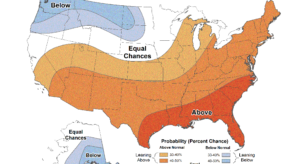
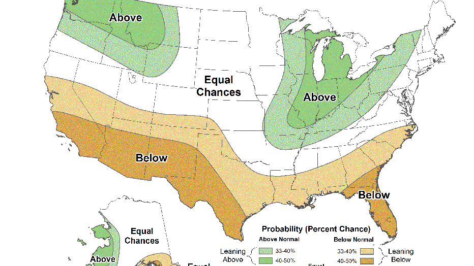
The Pacific Northwest has relatively high confidence of both cooler than average and wetter than average conditions during the December through February period.
NOAA Winter Outlook for temperature for December 2021- January 2022 (NOAA / FOX 13 Seattle)
This is no doubt in deference to our second go-around with La Nina, which returns for the 2021-22 winter after bringing a cooler and wetter winter last season.
NOAA Winter Outlook for precipitation for December 2021- January 2022 (NOAA)
La Nina is one of the three parts of the El Nino Southern Oscillation (ENSO) cycle, based on sea surface temperatures in the central and eastern tropical Pacific Ocean. When the waters are cooler than average, it's considered a La Nina, with the opposite warming effects named El Nino. When water temperatures are close to average, it's deemed to be neutral conditions.
Climate forecasters declared La Nina conditions present earlier this month and give an 87%-93% chance La Nina holds through the winter.
The ENSO cycle has a widespread influence on global weather patterns, especially in the winter. In the Pacific Northwest, the La Nina cycle typically brings cooler and wetter conditions as the polar jet stream frequently arcs north into the colder regions of the Northern Hemisphere, then pushes that cooler air south into the Northwest while also steering storms our way.
Already it's been a stormy and cool start to autumn with a stormy pattern in the works for the next several days, but La Nina usually does not exert its influence until around the beginning of the year.